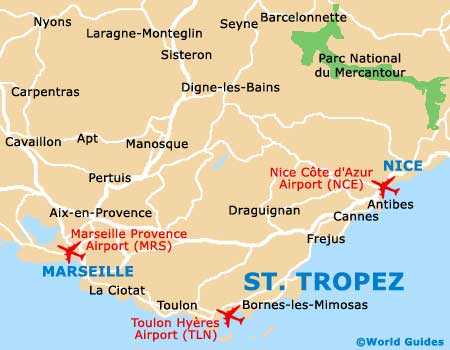
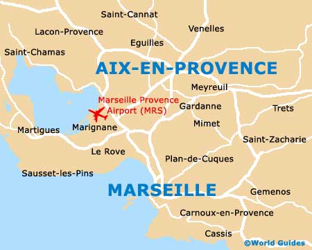
Marseille Provence Airport (MRS)
City Orientation and Maps
(Marseille, France)
The city lies in the Provence-Alpes-Côte d'Azur area of France, on the spectacular southern coastline. Marseille has expanded over the years and now has a population of more than 800,000, second only to Paris, with Marseille Provence Airport (MRS) being responsible for much of this growth and increased levels of visitors.
Marseille is conveniently close to a number of major cities, including Monaco, which lies approximately 225 km / 140 miles to the east and can be reached in just over two hours by car. Cannes and Nice lie on the coastline, alongside Monaco.
Also worth noting, Marseille is near Montpellier, which is around 170 km / 105 miles to the west, and even Barcelona in Spain can be reached by car, with a journey time of approximately four and a half hours.
Marseille Provence Airport (MRS) Maps: Important City Districts
Marseille is split into 15 main districts, known locally as arrondissements. These are all centred around the Vieux Port and spiral outwards.
To the north of the port you will find the historic old town area of Le Panier, where the boulevard of La Canebière is the main east / west thoroughfare. Other popular neighbourhoods of Marseille include the Centre Bourse, the Quartier Belsunce and the beaches. Particularly popular with visitors to Marseille is the Plage du Prado, which is known for its exceptional nightlife.
France Map

Marseille Map