Marseille Provence Airport (MRS)
Driving Directions / Travel by Car
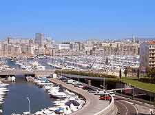
(Marseille, France)
Marseille Provence Airport (MRS) is situated about 20 km / 12 miles from the Marseille city centre. The airport is located on the N113 road at Marignane and near to both Vitrolles and Les Pennes-Mirabeau. Other locations close to Marseille Provence Airport include Martigues to the west, Salon-de-Provence to the north, and Aix-en-Provence to the north-east.
Notable roads next to the airport include the D-20, which skirts the eastern perimeter of the grounds, and also the D9c to the south.
Directions to Marseille Provence Airport (MRS) from the south of the city:
- Travel north on the A55 until you each the AT
- Drive north-east toward Marignane on the AT until you reach the N113. Follow the N113 to the airport
Directions to Marseille Provence Airport (MRS) from Avignon (north):
- Head south on the A7 and exit onto the N113
- Stay on the N113 and follow the signs to the airport
Directions to Marseille Provence Airport (MRS) from Aix-en-Provence (east):
- Travel south-west on the D9
- Exit the D9 onto the N113 for the airport
Directions to Marseille Provence Airport (MRS) from Nimes (west):
- Head east on the A54 toward Marignane
- Exit the A54 onto the N113 and follow the signs to the airport
The roads accessing the airport may experience traffic delays during the morning and evening rush hours, as well as on popular holidays. Be sure to leave well before your check-in time at Marseille Provence Airport if you plan on driving to the terminal during peak times.
Marseille Provence Airport (MRS): Virtual Google Maps
